

Tropical Storm Beryl: Hurricane Watch issued for Texas Coast; watches, warnings
TEXAS - As all eyes in Texas are on Tropical Storm Beryl in the Gulf, which has prompted the National Hurricane Center to issue watches and warnings for the Texas area.
Here are the watches and warnings that have been issued as of 10 a.m. Saturday.
SUGGESTED: Tracking Tropical Storm Beryl: How will it impact Texas and Houston?
HURRICANE WARNING
A Hurricane Warning is in effect for the Texas coast from Baffin Bay northward to Sargent.
A Hurricane Warning means that hurricane conditions are expectedsomewhere within the warning area. A warning is typically issued36 hours before the anticipated first occurrence oftropical-storm-force winds, conditions that make outsidepreparations difficult or dangerous.
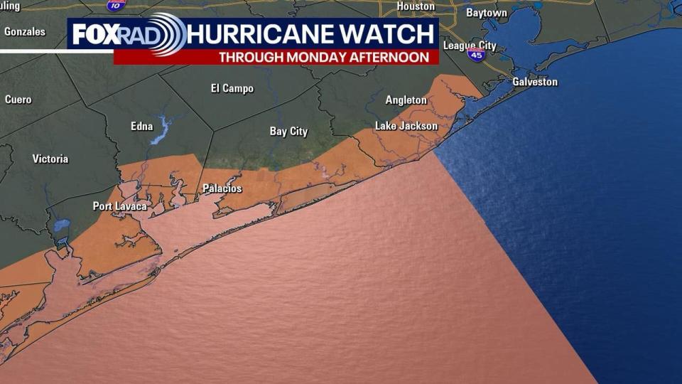
HURRICANE WATCH
A Hurricane Watch is in effect for the Texas coast south of Baffin Bay to the mouth of the RioGrande River and north of Sargent to San Luis Pass.
A Hurricane Watch means hurricane conditions are possible within the watch area. A watch is typically issued 48 hours before the anticipated first occurrence of tropical storm-force winds, conditions that make outside preparations difficult or dangerous.
TROPICAL STORM WARNING
A Tropical Storm Warning is in effect for the Texas coast south of Baffin Bay to the mouth of the Rio Grande River, as well as the northeastern coast of mainland Mexico from Barra el Mezquital to the mouth of the Rio Grande River.
The City of Houston issued a warning for southeast Harris County, including some portions of the Houston.
This type of warning means that tropical storm conditions are expected somewhere within the warning area within 36 hours.
STORM SURGE WATCH
A Storm Surge Watch is in effect for the Texas coast from the mouth of the Rio Grande River northward to High Island. This watch has also been extended to include the Bolivar Peninsula, Chambers, Coastal Galveston, Coastal Harris, and Galveston Islands.
According to ReadyHarris, potential rainfall amounts of five to 10 inches and gusty winds are possible.
This type of watch means that life-threatening inundation from rising water moving inland from the coastline is possible in the indicated locations during the next 48 hours.
How will Beryl impact Texas and Houston?
Get ready to "hunker down." The National Hurricane Center track hasn't changed much, still pointed in the general area of Corpus Christi, but the path is a weird one. Since it's moving up the coastline, any small movement left or right will make a big impact on landfall.
The bottom line is that the NHC still shows it hitting early Monday as a Category 1 hurricane, but we should be alert for a couple of things, especially a sudden strengthening right before landfall. Definitely hope that doesn't happen, but it's possible.
DOWNLOAD THE FOX 26 HOUSTON WEATHER APP BY CLICKING HERE
If you live on the coast or on Galveston or Matagorda Bay, be aware that the water level/storm surge could rise up to five feet. Winds will be highly dependent on the exact landfall location and any last minute category changes.
Be ready if the power goes out and make sure to have food, water, medicine, pet food, and other essentials just in case.

