


|
Getting your Trinity Audio player ready...
|
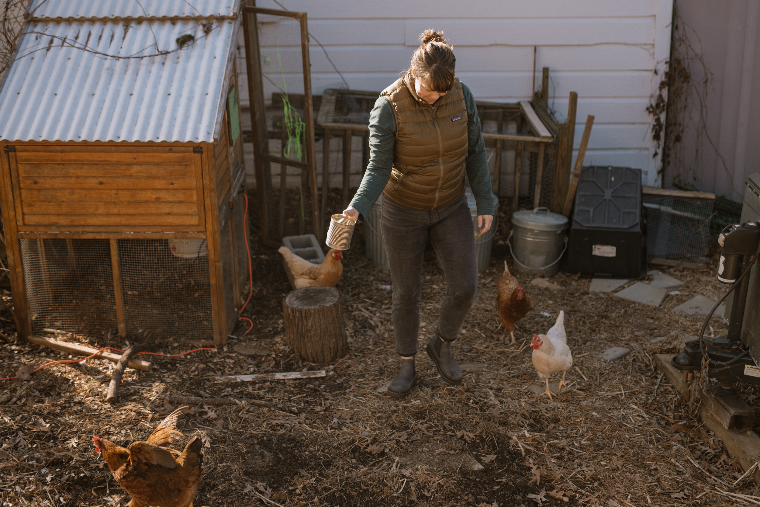
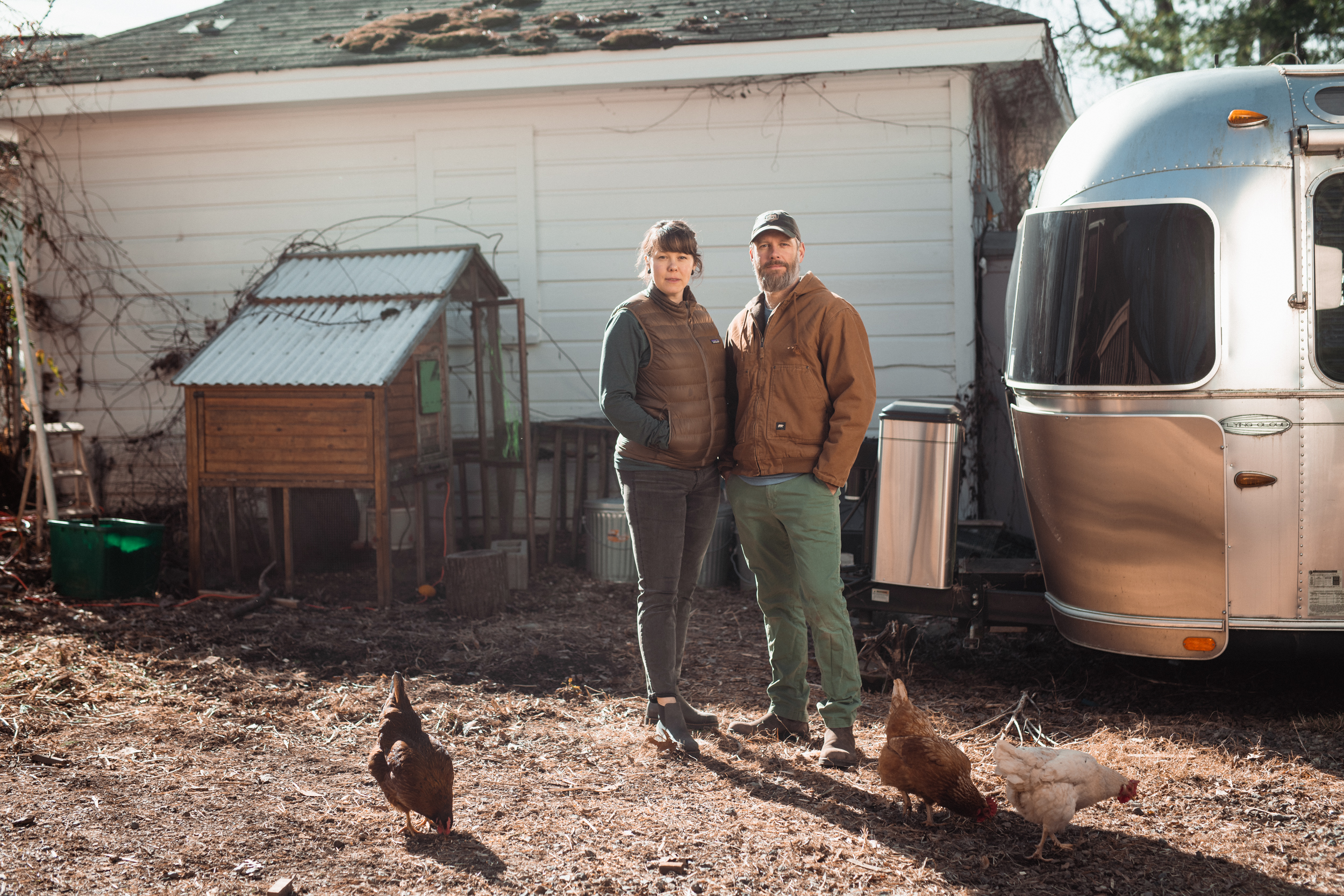
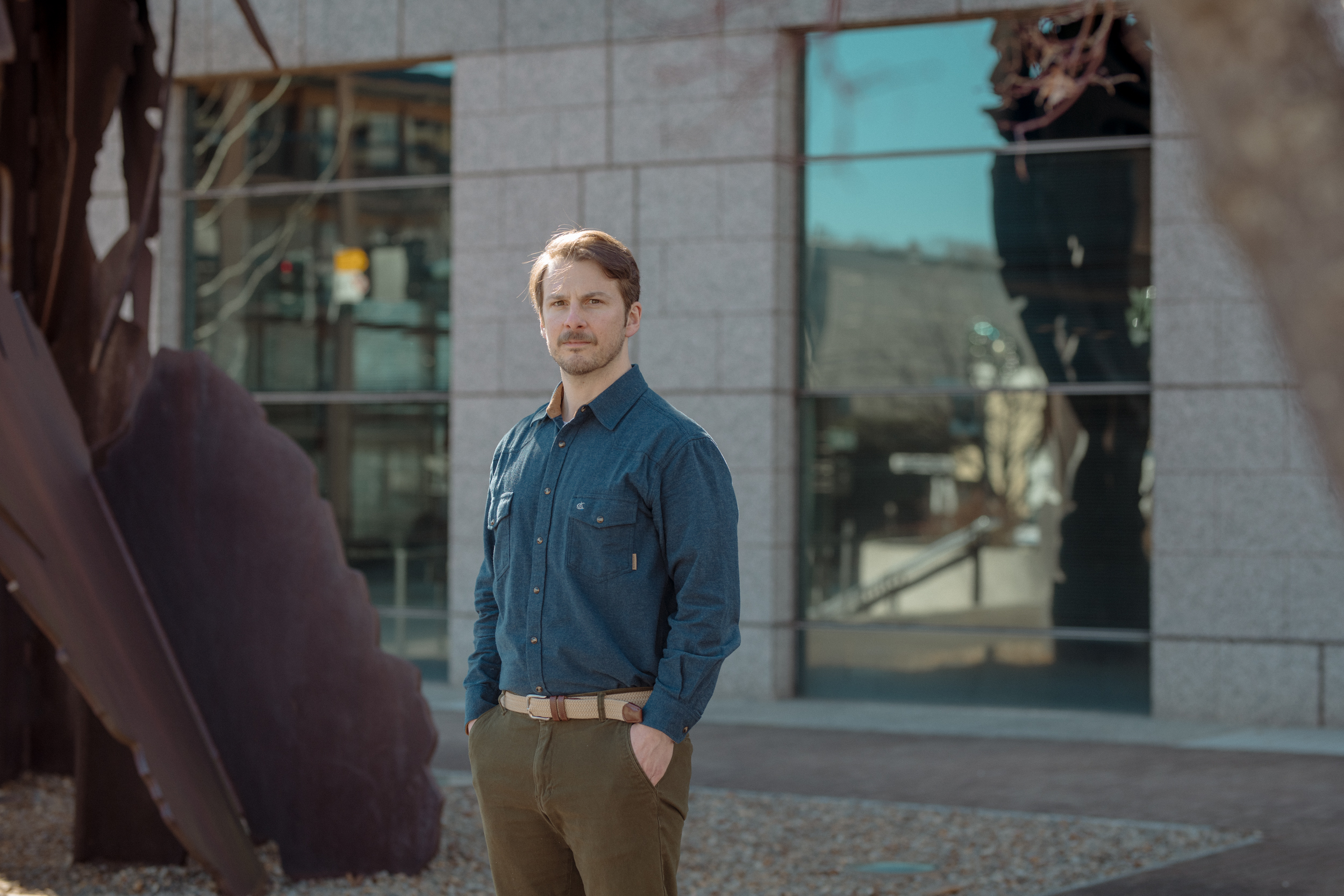
Soon after Ben Hanna and his wife Mandy bought seven acres of land near Nevada City, California in 2015, the one flaw of the weekend retreat that they’d imagined became apparent.
Wildfires were becoming increasingly common and destructive throughout the state, and the property didn’t have cell service. Whenever Hanna saw smoke, he’d use a drone to see where it was coming from, then get on his ham radio to find out if he, Mandy, and their son needed to evacuate. “With a kid, that started feeling really risky,” he said.
The public service announcements Nevada County issued failed to alleviate his concern. “The messaging was not, ‘If there’s a fire,’” he said. “The messaging was, ‘When the fire comes.’”
They felt safer at the duplex they owned in Oakland—until 2020 when the wildfires that burned much of Napa and Sonoma Valleys came within 50 miles of the city. “We couldn’t go outside because of the smoke,” said Hanna. “Our kid was 1 and was just starting to walk and was always banging on the front door.”
The day they sold their property in Nevada City in 2021, ash from a nearby wildfire was falling from the sky, confirming they’d made the right choice.
As the climate continues to warm, Hanna knew the danger in California was only going to get worse. “Every year the fire season gets longer,” he said. “In 10 years, it’s going to be a month longer, and you’re going to be on fire alert half the year.”
Working a remote job in the tech industry gave him the freedom to live anywhere. “We’ve got to get out of here,” he told Mandy. “It’s better to do it now than when everybody’s doing it.”
The Hannas started researching “climate havens,” a term often linked to a 2019 New York Times article featuring American cities that Jesse Keenan, then a lecturer at the Harvard University Graduate School of Design, deemed less likely to get walloped by hurricanes, droughts, and sea-level rise as global temperatures climb. They ultimately picked Asheville.
The Hannas are hardly an anomaly. According to the U.S. Census Bureau, the Asheville metropolitan area saw its population grow 10.8 percent between 2010 and 2022, and in a recent poll of 90 realtors, 95 percent said they’d had a client cite climate change as a reason for moving to the area.
“We’ve got to get out of here. It’s better to do it now than when everybody’s doing it.”
Ben Hanna
In a blog post, Hanna described his growing family—he and Mandy had since had two more children—as being “part of the first wave of U.S. climate migrants.” In contrast to anticipated future waves, these initial migrants get some say in where they want to move, an advantage that’s not lost on Hanna. “I feel privileged to be in a situation where I can relocate and make that choice early,” he said.
Guy Hoagland, another self-described climate refugee now living in Asheville, knows it’s a luxury many won’t have. “The second wave is going to be a disaster,” he said, “but it’s still going to be full of people who have some means. I think the third wave is the most worrisome. The third wave is people who have nothing.”
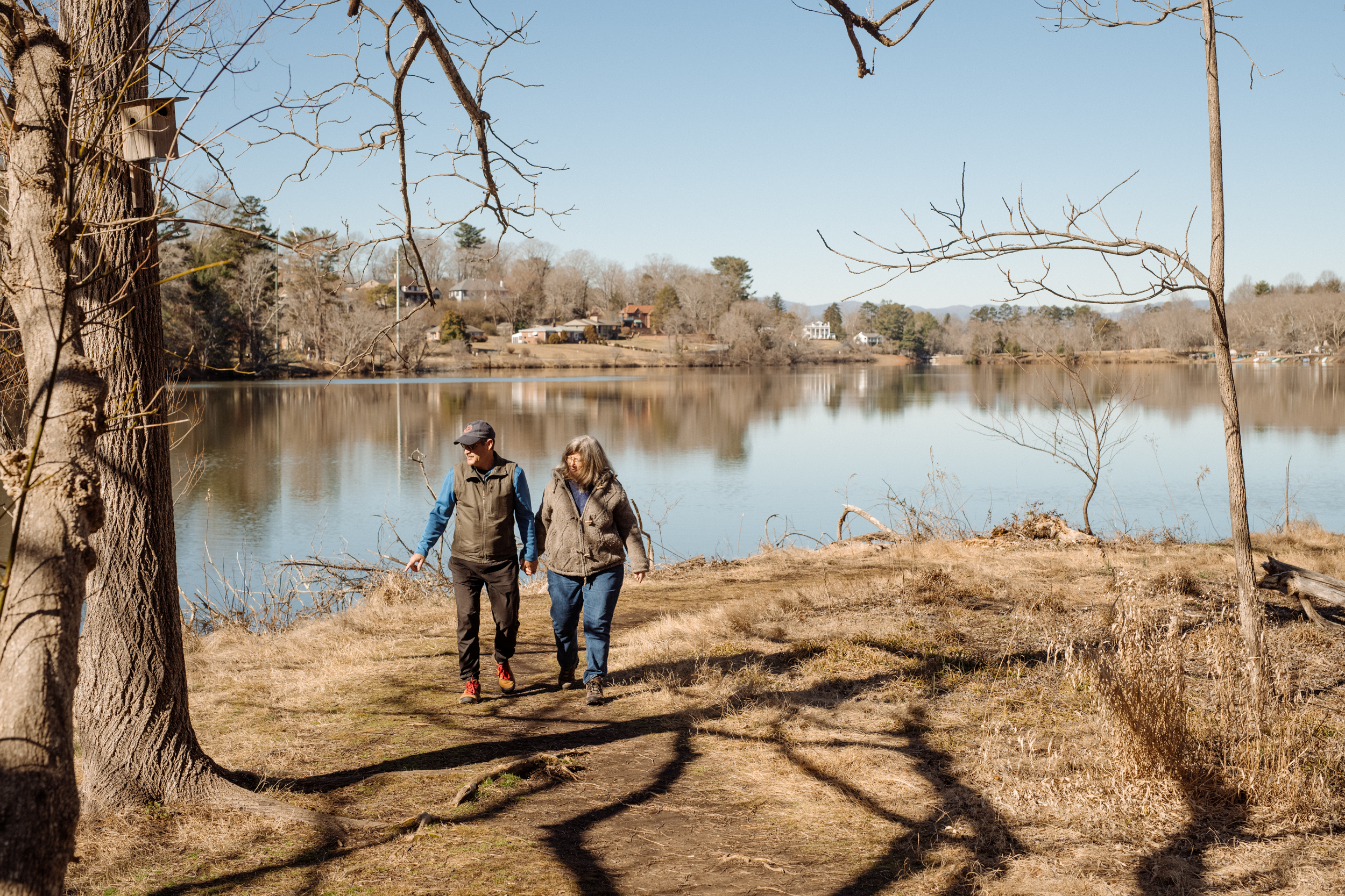
Hoagland and his wife Melissa, both retired doctors, raised their four children on Florida’s east coast from 1992 to 2015. They saw weather patterns change, and hurricanes increase in strength and volatility. “With the rapid intensification pattern, you think you’re getting a Category 2 hurricane,” said Melissa, “but when it arrives at your doorstep, it’s a Category 4.”
They were forced to evacuate eight times. There was one year they should have evacuated three times, but they were so exhausted from the second evacuation they couldn’t muster the energy to leave again.
They moved to California—first to Portola Valley, and later to Half Moon Bay, where a new climate-related hazard greeted them: wildfire. They were there when the Camp Fire destroyed much of the town of Paradise in 2018, and when the CZU Lightning Complex Fire burned all the way to the ocean in 2020. They started keeping “go bags”—backpacks full of emergency supplies—by their front door.

They moved to Asheville in April 2022. Like the Hannas, they weren’t aware that wildfires are common in North Carolina—and, thanks to climate change, becoming more frequent and more destructive. In the past three years the state has had the third most wildfires in the country, behind only California and Texas. North Carolina also ranks fourth in the number of homes located in the “wildland-urban interface,” a term the U.S. Forest Service uses to describe places where “humans and their development meet or intermix with wildland fuel.”
As climate change increases the number and intensity of wildfires across the country, this sprawling geographical zone is rapidly expanding, thanks in large part to real estate developers building in once-pristine areas. It now covers more than 30,000 square miles in North Carolina, or 37 percent of the state, and includes many areas in and around Asheville—a growing threat that became alarmingly clear last November.
How Did This Happen?
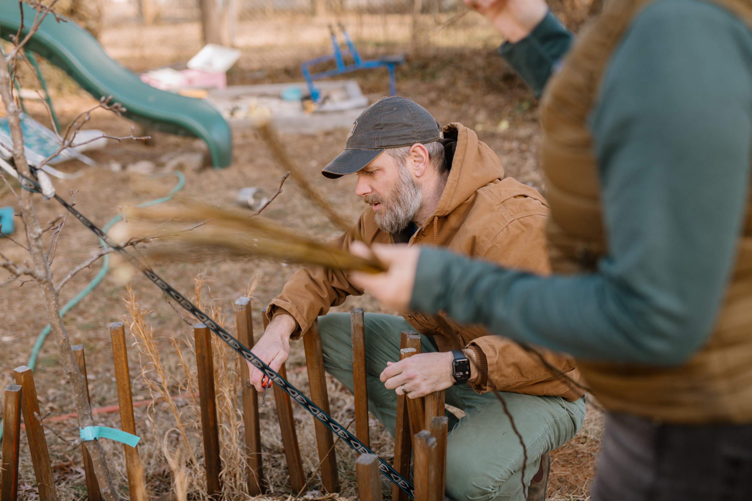
The Poplar Drive Fire started innocently enough. On October 26, 2023, Duff Swan applied for and received a permit to burn a debris pile on his property nine miles northeast of Hendersonville.
Swan, his wife Karem, and their 16-year-old son could also be described as climate refugees. Tired of the record-breaking heat in Florida, they were in the process of moving from the Orlando area to the 25-acre property Duff’s family had been using as a vacation spot since 1984.
Having done wildfire control work for the Water Management District in Maitland, Florida for 15 years, Swan had no illusions they were moving to a climate haven. He knew how common wildfires are in North Carolina. He also knew their house was in the wildland-urban interface and understood the new reality of living in such a place: the thing that made their home so pleasant to live in—being surrounded by nature—also made it dangerous.
To reduce the chances of a wildfire destroying his home, Swan started creating “a defensible space,” or buffer between his house and the surrounding forest, in early October. He removed all the trees and shrubs that were encroaching on his house and burned the resulting debris piles. A former certified prescribed burner, he had already burned six such piles on his property that month.
One of the essential ingredients of wildfire is drought. According to the National Centers for Environmental Information, October 2023 was the tenth driest October in the state since 1895, with just 1.15 inches of precipitation. The mountains and foothills were hit especially hard. Hendersonville only received 0.6 inch of rain that month.

The U.S. Forest Service created the Wildland Fire Assessment System as a data-driven tool to support its fire management decisions. One of its key components, the Keetch-Byram Drought Index, gauges the likelihood of wildfires becoming large and difficult to contain by rating droughts on a scale from 0 (no moisture deficiency) to 800 (maximum drought conditions). Despite the lack of rain, when Swan checked the index on October 26, the reading at the nearest station was 292. That was higher than on the days he’d previously burned, but not drastically so, and still well below the level that would suggest extreme caution was needed.
Swan has developed a measured approach when it comes to burning debris piles. He doesn’t burn on windy days, and he typically starts with a small pile and gradually brings debris to it rather than burning a large pile all at once. He estimated that the pile he burned that day covered somewhere between 500 and 1,000 square feet, or roughly the footprint of a very small house. He also used a garden hose to create a “wet line,” soaking the area around the pile with water. When his permit expired at 4 p.m., he used the hose to put out the flames.
“The second wave is going to be a disaster, but it’s still going to be full of people who have some means…The third wave is people who have nothing.”
Guy Hoagland
When Swan checked the ashes the following morning, he saw smoke in several spots and used hand tools and more water to extinguish them. He continued checking the area for the next seven days, and each time he found no signs of fire or smoke. On November 3 he checked it twice, once in the morning and again around noon, and saw nothing unusual. Two hours later, he was inside his house when he heard a noise no homeowner living in a region prone to wildfires ever wants to hear. It sounded like the hisses and pops of a fireplace blasting at full volume through a set of speakers. The fire had reignited.
He tried to contain it with a rake and hose, while Karem called 911. A crew from the Edneyville Fire and Rescue Station arrived within 30 minutes to discover a fire that was taking on a life of its own.
“By that time, it was in steep rough terrain,” said Swan. “The wind was blowing moderately out of the south-southeast. It wasn’t even a hard wind, but they couldn’t get a grip on [the fire]. They tried putting containment lines around it, but they couldn’t get it. And it ran to the top of the mountain.”
The North Carolina Forest Service is responsible for all wildland fires that occur beyond a hundred feet of an occupied dwelling, so Mike Cheek, an assistant regional forester for the agency, took over as the incident commander later that day. After surveying the scene, Cheek requested additional support.
He would need it. Wildfires tend to weaken at night when humidity rises and winds decrease, but that night a thermal belt trapped a band of warm air between cooler air below and above it, allowing the fire to remain active in that warm zone throughout the night.
When Swan looked out his window the next morning, he recognized the danger. “The wind is blowing hard, and it’s blowing from the north-northwest, and I said, ‘Uh oh, that’s not good.’” After crawling its way up the mountain the previous day, the fire had now turned in the opposite direction, and in Swan’s words, “It’s ripping.” After flowing past his house and jumping his driveway, the fire continued moving downhill straight toward a house on Kyles Creek Road, which Jon and Kristi Campbell had bought in February.
Recent transplants from Florida, the Campbells were in the process of evacuating. While Kristi got their dogs ready, Jon carried a box of important papers to their car. By the time he returned to get the other box they’d packed, the fire was a stone’s throw from their house. “When you walk outside your house and it’s 150 yards up the mountain and then three minutes later it’s 10 or 15 feet away from the back of your house, that’s scary,” he said.
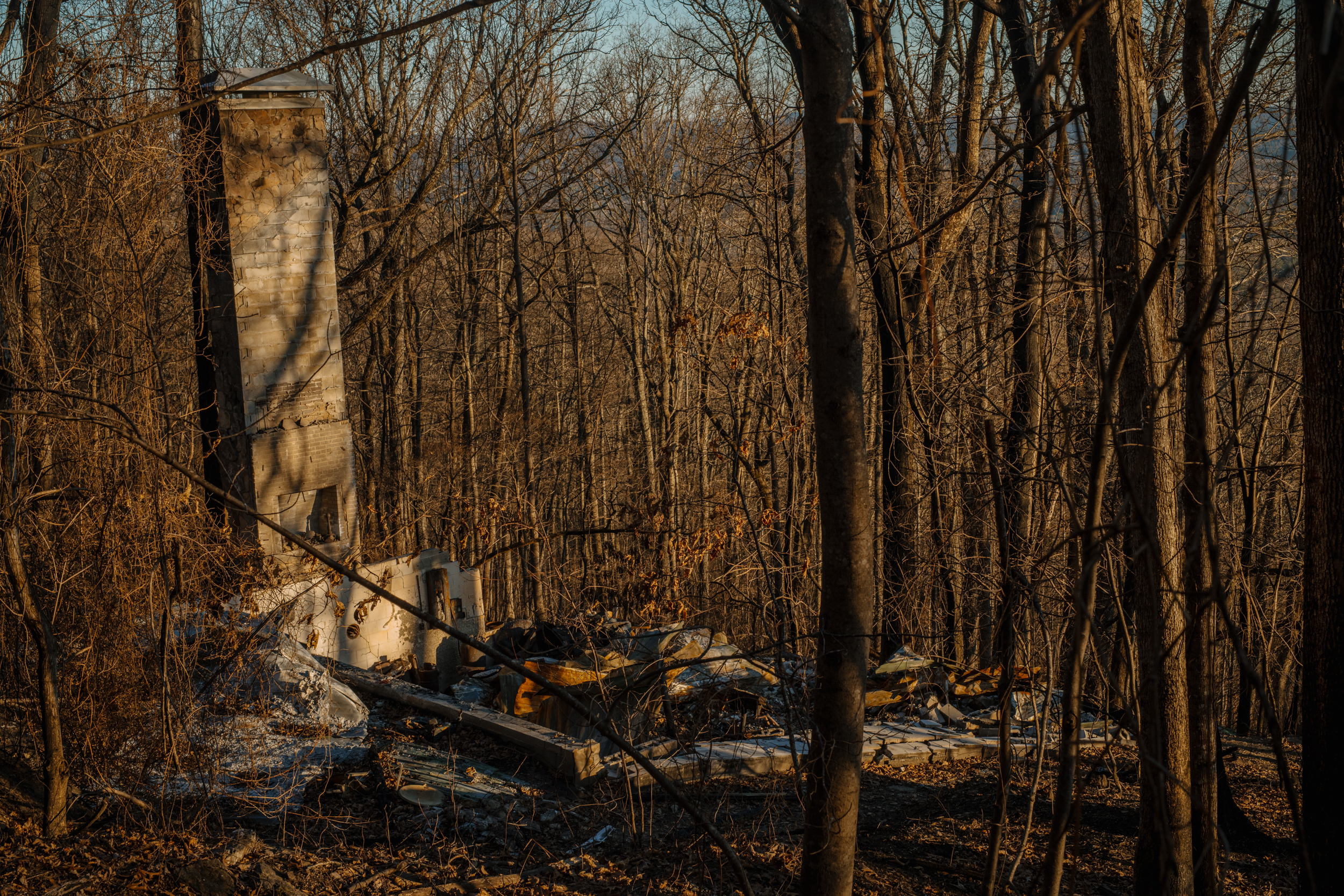
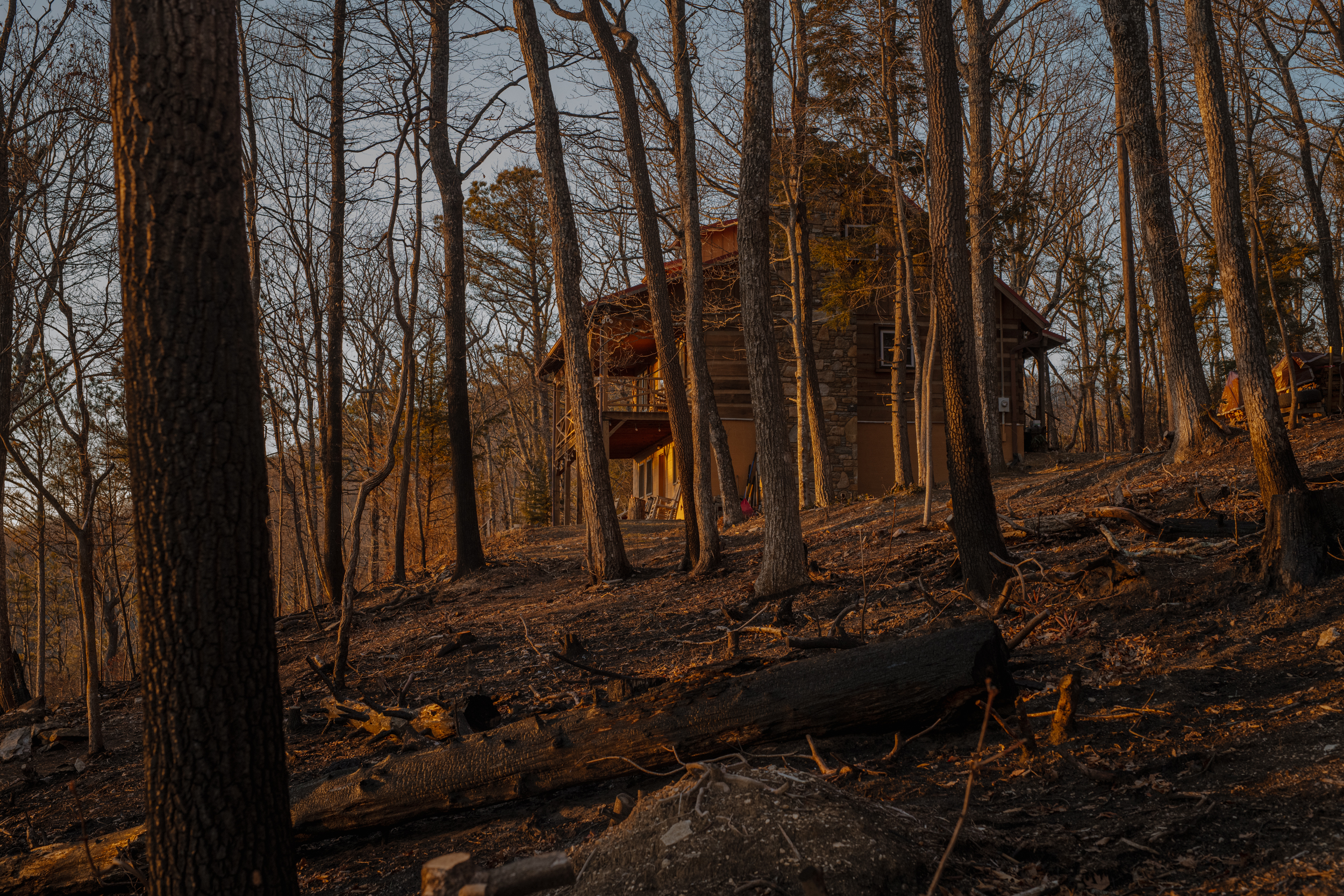
The Campbells retreated to downtown Hendersonville, 10 miles away. When they returned home that afternoon, they saw that the fire had burned the leaves and underbrush around the perimeter of their house and had even melted their plastic outdoor garbage can, but the house itself was fine. The Swans were similarly fortunate, as the fire burned a portion of their property but didn’t touch their house.
By the afternoon of November 4, the fire had grown to 175 acres and was only 5 percent contained, and when another thermal belt formed that night, it gained strength. At 2:15 a.m., the Campbells, who were spending the night in Hendersonville, received a call from fire dispatch. Their house was on fire.
Approximately 45 minutes later, eight firefighters knocked on the Swans’ front door and advised them to leave. Duff lobbied for staying; Karem started packing. A half hour later, the same crew returned and informed them that a mandatory evacuation was now in place. Duff asked what had changed. The firefighters told him the house just below them, which belonged to their close friends Russell and Betty Bolton who were in Florida at the time, had been lost. The Swans grabbed a few things and drove straight to Duff’s brother’s house in Savannah, Georgia.
By 9 a.m. Sunday, the fire had grown to 431 acres and was still only 5 percent contained. With the fire threatening to rage out of control, Kevin Harvell, the North Carolina Forest Service’s Piedmont Division Director, took command of the operation.
The service uses an incident command structure that rates wildfires on a scale from 5 (least complex) to 1 (the most). The Poplar Drive Fire was rated a 1, largely due to its location in the wildland-urban interface and the access, or lack thereof, to the site. “It’s pretty much a one-way-in, one-way-out area, which made it very difficult to get fire apparatus in and folks out,” he said. “The media interest was also very high, and when media interest is high, elected official interest is not far behind.”
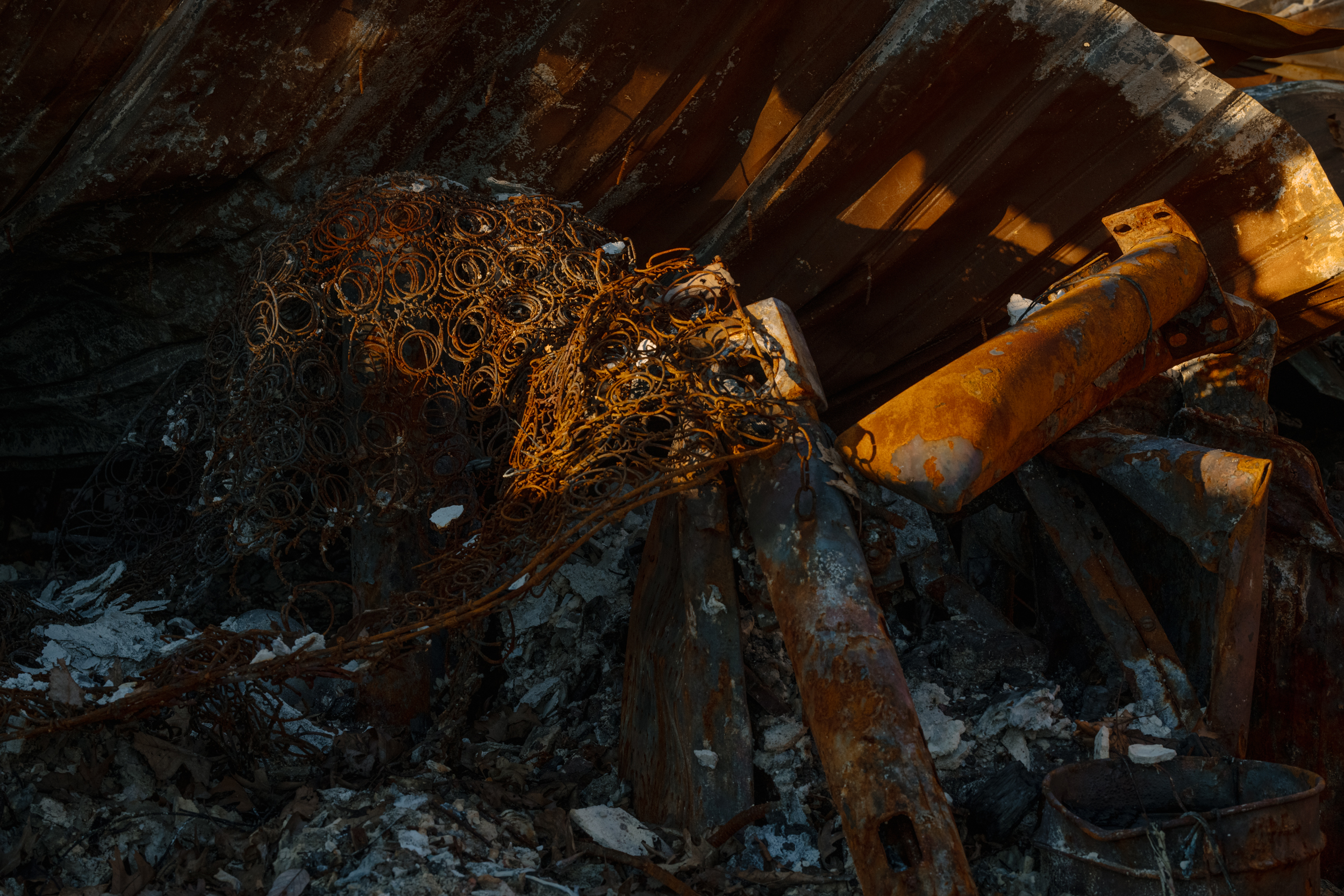
While Harvell’s team worked on containing the fire, Edneyville fire chief Robert Griffin focused his attention on the structures that had burned and the people who lived there. He met the Campbells at their house early Sunday afternoon. Its roof, ceiling, and rafters were badly burned as was the back deck. The mudroom was gone. Glass from picture frames littered the floor. The television in the living room had melted off the wall. Water was everywhere. And everything was black from smoke.
“After you dodge a bullet, then it returns, you get a little angry,” said Jon. “You wonder, ‘Why me? How did this happen?’”
Loading the Dice
Wildfire is an essential part of North Carolina’s natural environment. Some plants need fire to open their seed pods. Others rely on it to remove competition. In the coastal plain, wildfire creates the mineral soil that allows longleaf pine forests to thrive. In the mountains, it clears out fast-growing, shade-tolerant species such as tulip poplars, allowing oaks and hickories, which provide food and shelter to numerous animals, to flourish.
Historically, wildfires were allowed to burn until they extinguished themselves, but after several major wildfires ravaged the mountains at the beginning of the 20th century, the General Assembly authorized the first state fire wardens in 1915. “Their original mission was to control the fires because they were getting out of hand,” said Joseph Roise, a professor at NC State’s Department of Forestry and Environmental Resources. “Then in the 1940s there was a big push across the nation to extinguish all fires. That allowed fuel to build up in the mountains for a good 40 years.”
In the 1970s, wildfire experts reversed course, advocating for allowing wildfires to burn and using prescribed burning as a proactive measure. “Ultimately, we need more fire on the landscape,” said Nicholas Shanahan, an outreach and engagement specialist at the North Carolina Institute for Climate Studies. “It’s truly an issue of fire fighting fire because the more low-intensity fires you have, the less likely you’ll have a catastrophic fire.”
After nearly 40 years of fire suppression, fuel loads increased to dangerous levels in certain parts of the state. One such area was Bald Top Mountain, the densely forested knob in Henderson County where the Swans’ property is located.
Humans caused 85 percent of the wildfires in the U.S. between 2000 and 2017, and 99 percent of the wildfires in North Carolina last year. So when looking for the cause of the Poplar Drive Fire, the easiest thing to do is blame Duff Swan—and that’s exactly what people did on social media, without knowing how experienced he was or how careful he’d been.
The forest service cited Swan for violating the general statute that requires “keeping and maintaining a careful watchman.” Swan pointed out that the statute fails to indicate how long someone who’s been issued a burn permit is supposed to keep an eye on the ashes. One week? Two? That’s not the only flaw he sees in the current system. The bar one needs to clear to obtain a burn permit is shockingly low. “You don’t need any experience with fire to burn at your house,” he said. “All you have to do is go online. You get a permit immediately. They don’t even look at the weather.”
Drought, high temperatures, and low humidity set the stage for wildfires, but wind is the variable that can turn a tedious one-act play into a spectacular Broadway show. “When the winds are from the west-southwest, the west side of the mountains soaks up all the rain,” said Roise, “and what comes down the other side is drier air and it tends to dry out the fuels. The drier the fuel the more net energy comes out of it.”
And the faster the wind blows, the more destructive wildfires can be. On November 19, the Poplar Drive Fire was declared 100 percent contained. Three days later, the North Carolina Forest Service lifted the burn ban it had issued for 14 Western North Carolina counties. According to the National Weather Service, there were wind gusts as high as 35 mph that day.
Counterintuitively, heavy rainstorms can also increase the severity of wildfires if they’re immediately followed by drought, a pattern climate change is making increasingly common. “The more evenly distributed water is across the landscape, the less wildfire there is,” Roise explained. “But now we’re getting heavier rainfalls. The frequency of a storm dropping two or three inches has increased. In the future we’ll get more rain, plants will grow, it will be nice and lush, then it will dry out, and we’ll have a major fire.”
There are two wildfire seasons in North Carolina: the spring, which starts after temperatures begin rising and before trees start leafing out, and the fall, which starts after the leaves have fallen and before temperatures start dropping. Climate change is lengthening these seasons. The state had 19 more “fire weather days” in 2022—days when hot, dry, windy conditions increase the chances of a wildfire—than it did in 1973, and that number is projected to continue rising. According to the 2020 NC Climate Science Report, the number of weeks with conditions conducive to very large wildfires is expected to increase more than 300 percent in the coastal plain and by 50 to 100 percent in the mountains by the middle of the 21st century.
The chances of a future wildfire in the western portion of the state becoming as catastrophic as the wildfires in Paradise, California, and Lahaina, Hawaii is especially high in the mountains, thanks to its rugged terrain.
“Climate change ‘loads the dice,’” said Shanahan, borrowing a metaphor from famed climate scientist Dr. James Hansen. “All these things that would be so rare historically are becoming more likely in a place that is heavily forested and is, from a wildfire-fighting perspective, a very dangerous place to live.”
‘A Very Uncomfortable Sense of Déjà Vu’
To many people, climate change is an intangible threat. But one very obvious way that it’s manifesting is in rapidly rising home insurance rates.
In January, the North Carolina Rate Bureau asked the North Carolina Department of Insurance to increase homeowners’ insurance rates by an average of 42.2 percent across the state. Besides inflation, climate change, specifically coastal flooding and wildfires, was the driving factor.
The Hoaglands have firsthand experience with climate-driven insurance rate hikes. When they lived in Florida, only one company was willing to insure their house, and that plan cost more than $8,000 a year. Their insurance woes followed them to California, where they were told they couldn’t get home insurance unless they replaced their cedar shake roof, as it was considered a fire hazard.
Another way climate change has started disrupting people’s lives is via wildfire smoke. “Everybody assumes that if they’re not in an area that’s at a high wildfire risk, they won’t be affected by it,” said Melissa, “but smoke blows everywhere.”
Before last November’s wildfires forced Gov. Roy Cooper to declare a state of emergency, the threat of fire had already made itself known by way of smoke that drifted down from Canada in June 2023.
The ominous haze triggered Ben Hanna’s climate-related trauma. “I thought, ‘Here we go again. There’s no place to escape.’ Even though that was thousands of miles away, I was like, ‘This just may be life. There’s nowhere to go that’s immune.’”
“All these things that would be so rare historically are becoming more likely in a place that is heavily forested and is, from a wildfire-fighting perspective, a very dangerous place to live.”
Nicholas Shanahan, North Carolina Institute for Climate Studies
Concern about wildfire smoke is warranted. Evan Couzo, a professor of atmospheric sciences at UNC-Asheville, warned of its growing danger. “The trajectory of air quality across the United States over the last 50 years is a good-news story,” he said. “But climate change appears to be eroding some of those successes in large part because of wildfires.”
Thanks to the efforts of the North Carolina Forest Service as well as some much-needed rain and a drop in temperatures that arrived a week after the fire started, the Poplar Drive Fire wasn’t as destructive as it could have been. Only two houses burned—remarkably, the Swans’ house was unscathed—and no one was seriously hurt. But it remains a cautionary tale.
Given the increasing severity of wildfires and the rapid expansion of home construction in North Carolina’s wildland-urban interface—it contains at least 2.1 million houses—the next time Western North Carolina experiences a bad wildfire season, the harm to homes and people could be much worse. The danger is particularly acute in Buncombe County, where, as of 2020, more than 71 percent of the land was in the wildland-urban interface.
That’s a sobering thought for those who moved there looking for a safer place to live.
“I’m confident we made the right call,” said Hanna, “but we moved early enough that there’s still questions about it. Was this the right thing to do? Did we need to do this?”
“There is climate risk everywhere,” he continued. “The fact that we have fires here isn’t awesome, but the risk of all the other natural disasters is much lower here.”
For the Hoaglands, moving to Asheville wasn’t a panacea, but it has lowered their stress somewhat. They still have go bags, but now they keep them in their garage instead of by their front door. Melissa described the feeling the Poplar Drive Fire engendered in her as “a very uncomfortable sense of déjà vu.”
Shanahan warns against seeing any place as “safe” from climate impacts. “The perception is that this area is a climate haven and that’s very dangerous because people think, ‘We made it. We left Southern California. We left South Florida. We sold our home on the Outer Banks. And we moved here and now we’re good,’” he said. “That’s not really the case, as we’re only beginning to see the direct effects of climate change in our daily lives. There is no such thing as a climate haven.”
Storms Reback has written five nonfiction books, including Ship It Holla Ballas!: How a Bunch of 19-Year-Old College Dropouts Used the Internet to Become the Loudest, Craziest, and Richest Crew and In Full Color: Finding My Place in a Black and White World. He lives in Asheville and is a regular contributor to the Mountain Xpress.